
New York City has an ambitious vision to expand its greenways by 40 miles, offering a continuous walk around Manhattan and car-free cycling from Brooklyn to Far Rockaway. Released on Wednesday, the “Greater Greenways” plan is the city’s first master plan for its greenway network in more than 30 years. The plan assesses the existing 500 miles of paths and proposes new pedestrian and cycling routes to fill in existing gaps across the five boroughs, with construction on some short-term projects beginning as early as 2028.
“Our citywide network of greenways connects New Yorkers with their neighbors and with the great outdoors, providing safe and accessible places to work up a sweat or take a stroll, and to appreciate the beauty of the five boroughs,” NYC Parks Commissioner Iris Rodriguez-Rosa said.
“We’re proud of our work to maintain and expand this vital public resource, and we look forward to building on these efforts with our partners throughout city government to ensure that our greenway network continues to meet New Yorkers where they are, regardless of ZIP code.”
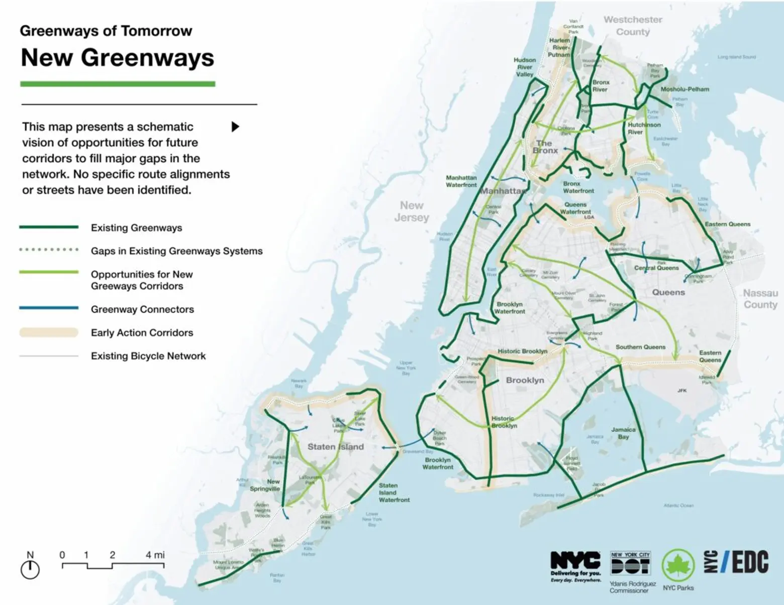
The plan is divided into two chapters: Greenways of Today and Greenways of Tomorrow. The first section gives an overview of the existing network and maps the 506 miles of bicycle and pedestrian corridors. It then analyzes the benefits of greenways, such as enhancing transportation options, improving safety, and expanding access to green space.
Chapter two outlines the plan’s visions and goals, which include: enhancing NYC’s transportation network; promoting social equity and accessibility; supporting health and wellness; fortifying environmental resilience; and fostering economic growth.
Specifically, the plan identifies gaps in the existing network and references the work currently underway to create new corridors as well as new potential greenways—many of which are in Brooklyn and Queens. It allows New Yorkers to see the more than 100 planned and underway projects for the first time.
In Brooklyn, the plan calls for closing major gaps in the Brooklyn Waterfront Greenway through Dumbo, Red Hook, and Sunset Park, with several capital projects set to move forward in the coming years. When finished, the 25-mile path will connect more than 20 neighborhoods from Greenpoint to Sheepshead Bay.
In Queens, the plan calls for closing waterfront gaps from Long Island City and Astoria to East Elmhurst and College Point. In southern Queens, a new Jamaica Bay Greenway would add 28 miles of pedestrian and cycling paths linking communities along the Jamaica Bay waterfront.
Six corridors have been targeted for expansion, including a seven-mile portion in southern Queens spanning from Spring Creek Park to Brookville Park near John F. Kennedy International Airport. The route could make the airport—and its 35,000 employees—accessible by bike.
In Manhattan, the plan would close the remaining gaps in the Manhattan Waterfront Greenway, creating a continuous loop around the borough. Building on a 2017 study that identified missing links and two areas in critical need of upgrades, many of the projects would be in historically underserved communities along the east side.
The city opened the East Midtown Greenway and the second phase of Andrew Haswell Green Park in December 2023, delivering nearly three acres of public open space, a pedestrian walkway and bridge, landscaping, and a separate bike lane stretching from East 53rd Street to East 60th Street along the East River.
In the Bronx, the plan identifies existing projects, such as the expansion of the Harlem River Greenway, which began in May. The project aims to create a seven-mile greenway from Van Cortlandt Park to Randall’s Island Park, better connecting Bronx residents to their waterfront with new open space and bike routes.
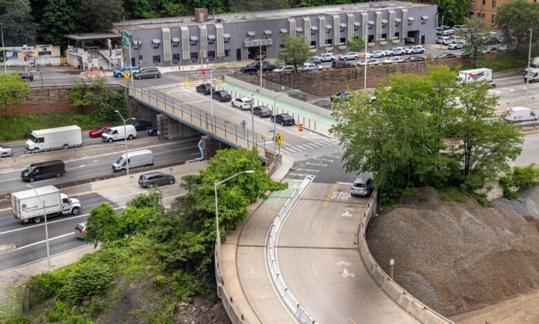
The Bronx has some of the city’s oldest greenways, which the plan says should be prioritized for repairs and upgrades. Proposed improvements include bringing them up to modern design standards to reduce conflicts between motorists, cyclists, and pedestrians, particularly at exit ramps and overpasses along the Hutchinson River Greenway.
It would also create a 10-mile waterfront greenway along Staten Island’s North Shore between the Goethals and Verrazzano-Narrows Bridges.
The plan was published by the city’s Department of Transportation and Parks Departments, along with the Economic Development Corporation. However, while some of the projects could start as early as 2028, the agencies made no promise that the plan will actually come to fruition, and offered no cost estimate or exact timeline for work, according to Gothamist.
Mayor Eric Adams was required to publish the master plan under a 2022 City Council law that took effect after he declined to sign the bill, resulting in a seven-month delay, as reported by Time Out.
In July, the city removed a section of a protected bike lane along Bedford Avenue in Brooklyn after a contentious legal battle. Opponents cited high-profile incidents of cyclists colliding with children, while supporters pointed to a reduction in injuries along the corridor, according to Streetsblog.
“Public spaces create vibrant spaces where New Yorkers can move, play, and thrive, and our administration is committed to increasing access to public spaces like parks and waterfronts for every New Yorker,” Adams said.
RELATED:
Source link