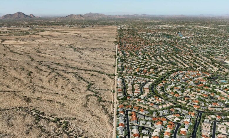

Edward Burtynsky, courtesy Howard Greenberg Gallery, New York
There is no geophysical logic to the sharp partition in the middle of this picture. A US federal act, the Land Ordinance of 1785, divided North America’s vast western territories into rectilinear townships and sections. So when pumps pull water out of the aquifer beneath Salt River Valley, Arizona, squares of desert like this suburb of Phoenix grow green, settled and busy.
The Indigenous Pima and Maricopa peoples used to farm this land; it was turned into this comfortable conurbation in the 2000s. Valley settlements like this one depend on an increasingly complex and costly water-management system.
Photographer Edward Burtynsky was in a helicopter on his way to the already-desertified Colorado river delta in Mexico in 2011 when he spotted this place. As a student, his first assignment had been to “capture evidence of the activities of man”. He likes to say that, after 40 years of pioneering effort with large-format colour, digital and drone photography, he has more or less delivered. “I was out there early,” he says, “trying to figure it all out, trying to tell the story of our impact on the planet.”
This shot and more of Burtynsky’s photos are being exhibited in a solo exhibition, The Great Acceleration, at New York City’s International Center of Photography until 28 September.
Topics:
Source link