 No views of New York City are more iconic than looking from the harbor toward Manhattan. The Dutch who first settled Manhattan sketched the island with little more than a fort, a windmill, a dozen houses rising near the shore, and Indigenous people paddling around the bay. Four centuries later a photographer captured the new One World Trade Center half-clad but already towering over Wall Street.
Regular New York Almanack contributor Bill Greer has developed an online gallery of thirty-two images framed by those two.
The gallery chronicles how this perspective of the city has transformed through four centuries and into a fifth. It explores the Dutch period and the transformation during the English takeover.
 In the 19th century, it begins with watercolors of a low-rise Manhattan shoreline by William Gay Wall and Thomas Birch and ends with cartographic images of a heavily built-up island and an early photographic panorama by William W. Silver.
The 20th century chronicles the rising skyline and the decline of ships filling the harbor.
A Brooklynite for four decades, Greer has written and spoken about New York history from its Dutch era into the 21st century. He has published two books about the city, the nonfiction narrative A Dirty Year: Sex, Suffrage, and Scandal in Gilded Age New York, and the historical novel about the Dutch era, The Mevrouw Who Saved Manhattan.
 He has served as an officer and trustee of the New Netherland Institute and chaired the Institute’s program to establish the New Netherland Research Center with the New York State Library.
You can view the gallery on Bill Greer’s website here.
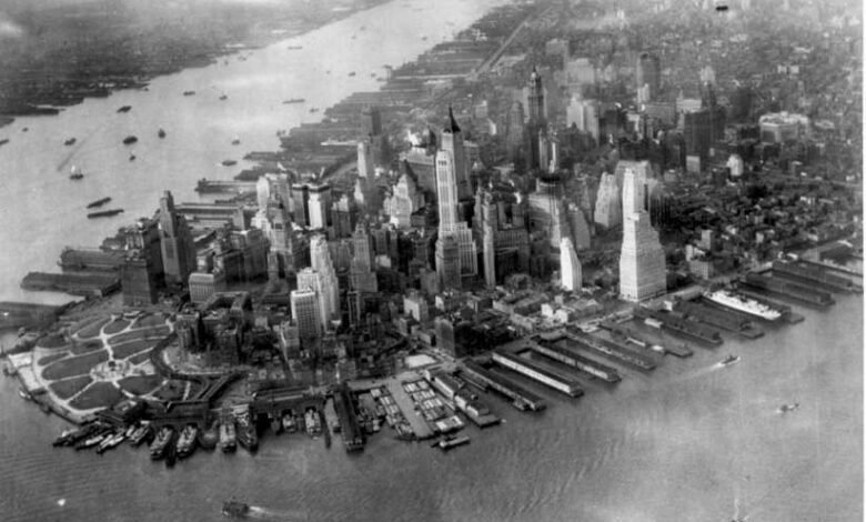
Illustrations, from above: The earliest known drawing of Manhattan, 1626, from Description of New Netherland by Adriaen van der Donck, 1655; “Birds Eye View of New-York & Brooklyn,” lithograph by John Bachman, 1851 (Metropolitan Museum of Art); and Aerial View of Lower Manhattan, 1947 (National Archives)
Source link